LivePassWatch › United States › Alaska

Alaska Mountain Passes Live Conditions & Road Status

Real-time open/closed reports, winter closure schedules, webcams, and mountain pass updates across Thompson Pass (AK-4), Atigun Pass (Dalton Highway), Hatcher Pass, and Turnagain Pass. Verified live via Alaska DOT&PF and 511 Alaska.

AKDOT&PF Live Feed • Updated Today • 12 Passes Monitored
Open Now
3
Caution / Seasonal
3,145 m
High Col (Kahiltna)
500+ in
Annual Snow (Thompson)

Alaska Mountain Passes Topographical Map

Click the map to view high-resolution satellite topography and geographical pass corridors.

Detailed Topographic Map of Mountain Passes in Alaska
Interactive Map · Click image to expand fullscreen • 14 Passes Mapped
Chilkoot Pass (1,067 m) Chilkat Pass (1,070 m) Hatcher Pass (1,185 m) Johnson Pass (442 m) Kahiltna Pass (3,145 m) Mentasta Pass (742 m) Moose Pass (144 m) Polychrome Pass (1,126 m) Portage Pass (244 m) Powerline Pass (975 m) Resurrection Pass (792 m) Thompson Pass (855 m) Turnagain Pass (305 m) White Pass (873 m)

Elevation Comparison of Alaska Passes

From coastal Kenai sea-gaps (144 m) to alpine Alaska Range cols (3,145 m)

Click any dot for pass details
500 m 1,000 m 3,000 m (Alpine) Moose Pass (144 m / 472 ft) · Open Portage Pass (244 m / 800 ft) · Open Turnagain Pass (305 m / 1,000 ft) · Open Johnson Pass (442 m / 1,450 ft) · Open Mentasta Pass (742 m / 2,434 ft) · Open Resurrection Pass (792 m / 2,600 ft) · Open Thompson Pass (855 m / 2,805 ft) · Open White Pass (873 m / 2,864 ft) · Open Powerline Pass (975 m / 3,200 ft) · Open Chilkoot Pass (1,067 m / 3,500 ft) · Seasonal Caution Chilkat Pass (1,070 m / 3,510 ft) · Open Polychrome Pass (1,126 m / 3,695 ft) · Park Shuttle Only Hatcher Pass (1,185 m / 3,886 ft) · Open (West Crest Seasonal) Kahiltna Pass (3,145 m / 10,320 ft) · High Col / Expedition
● Open / Maintained ● Seasonal / Caution ● Storm Closure Official DOT&PF elevation datum

The Five Passes to Build an Alaska Trip Around

Our curated ranking of the most scenic, dramatic, and iconic mountain crossings in the Last Frontier.
1
Thompson Pass, Alaska

Thompson Pass

Richardson Highway (AK-4) · Chugach Mountains Open
The snowiest highway pass in North America, plunging through towering peaks and blue glaciers towards the coastal fjord of Valdez.
855 m / 2,805 ft
summit crest
2
Hatcher Pass, Alaska

Hatcher Pass

Fishhook-Willow Rd · Talkeetna Mountains Open
Alpine cirques, pristine tarn lakes, and the historic 1930s Independence Gold Mine perched above the Matanuska Valley.
1,185 m / 3,886 ft
summit crest
3
Turnagain Pass, Alaska

Turnagain Pass

Seward Highway (AK-1) · Kenai Peninsula Open
An All-American Road winding between jagged snow-clad mountains; Alaska's premier winter skiing, boarding, and snowmachining playground.
305 m / 1,000 ft
summit crest
4
White Pass, Alaska

White Pass

South Klondike Highway (AK-98) · Boundary Ranges Open
Epic international mountain gateway from Skagway into Canada, paralleling the legendary 1898 White Pass & Yukon Route cliffside railway.
873 m / 2,864 ft
summit crest
5
Polychrome Pass, Alaska

Polychrome Pass

Denali Park Road · Alaska Range Restricted (Park Transit)
Heart-stopping cliff road cut into multi-colored volcanic bluffs overlooking the wild river braided plains of Denali National Park.
1,126 m / 3,695 ft
summit crest

Southcentral & Kenai Peninsula

Chugach National Forest • Seward Highway Corridors • Fjord Gateways
6 passes
Turnagain Pass road in Alaska Open Paved Highway

Turnagain Pass

Seward Highway (AK-1) • Milepost 68
305 m (1,000 ft) summit • 4-Lane Divided
Chugach NF Year-Round Avalanche Center

High mountain gap separating Turnagain Arm from the Kenai Peninsula. Heavy winter snowfall with motorized (west) and non-motorized (east) recreational zones.

🔗 pass.info/united-states/alaska/turnagain-pass
Moose Pass along Upper Trail Lake Alaska Open Scenic Byway

Moose Pass

Seward Highway (AK-9) • Milepost 29
144 m (472 ft) summit • Paved
Kenai Peninsula Year-Round Waterwheel

Historic glacier-carved corridor nestled along Upper Trail Lake. Known for picturesque timbered peaks, Alaska Railroad junctions, and mountain trailheads.

🔗 pass.info/united-states/alaska/moose-pass
Johnson Pass mountain trail Kenai Peninsula Alaska Open Highway & Historic Trail

Johnson Pass

Seward Hwy Corridor • Historic Iditarod
442 m (1,450 ft) summit • 23-mi Trail
Kenai Mountains Salmon Streams Forest Trail

Historic 1910 Iditarod mail trail pass connecting Granite Creek to Trail Lake. Highway corridor open all year; alpine trail open for summer hiking and winter skiing.

🔗 pass.info/united-states/alaska/johnson-pass
Portage Pass overlooking Portage Glacier and lake Alaska Open Tunnel & Alpine Trail

Portage Pass

Portage Glacier Rd • Anton Anderson Tunnel
244 m (800 ft) summit • 4-mi Trail / Rail-Tunnel
Whittier Fjord Glacier Overlook Staged Tunnel

Sole land connection between Prince William Sound and Turnagain Arm. Overlooks calving Portage Glacier and the sheer granite peaks of Whittier fjord.

🔗 pass.info/united-states/alaska/portage-pass
Powerline Pass in Chugach State Park near Anchorage Alaska Open Multi-Use Mountain Pass

Powerline Pass

Glen Alps to Indian Valley • Chugach State Park
975 m (3,200 ft) summit • 11-mi Route
Anchorage Alps Mountain Bike Moose Habitat

Anchorage's most traversed alpine pass, cutting through the Front Range between Campbell Creek and Indian Creek. Popular for hiking, fat-biking, and backcountry skiing.

🔗 pass.info/united-states/alaska/powerline-pass
Resurrection Pass with public cabin and lake Alaska Open National Recreation Trail

Resurrection Pass

Hope to Cooper Landing • Chugach NF
792 m (2,600 ft) summit • 38-mi Trail
Public Cabins Gold Rush Packway Dall Sheep

The crown jewel backcountry pass of the Kenai Peninsula. Above tree-line tundra crossing with sweeping lake vistas, historic cabins, and caribou/sheep herds.

🔗 pass.info/united-states/alaska/resurrection-pass

Valdez & Eastern Alaska Range

Chugach Mountains • Richardson Highway • Tok Cutoff National Network
2 passes
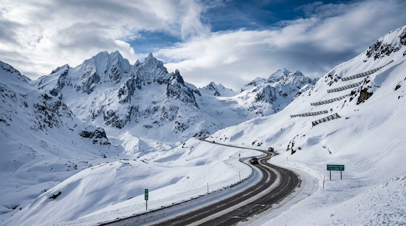
Thompson Pass on Richardson Highway Alaska Open Paved Highway System

Thompson Pass

Richardson Highway (AK-4) • Milepost 26
855 m (2,805 ft) summit • Paved All-Weather
Snowiest in US Keystone Canyon Valdez Link

Legendary maritime-alpine pass dropping into Valdez. Notorious for extreme 900+ inch snowfall seasons, heli-skiing, pipeline corridor, and high-wind blizzards.

🔗 pass.info/united-states/alaska/thompson-pass
Mentasta Pass on Tok Cutoff Highway Alaska Open Paved Highway

Mentasta Pass

Tok Cutoff (AK-1) • Milepost 77
742 m (2,434 ft) summit • Paved 2-Lane
Alaska Hwy Cutoff Mentasta Mtns Year-Round

Critical freight artery through the Mentasta Mountains linking the Alaska Highway at Tok with Glennallen, Anchorage, and the Gulf coast ports.

🔗 pass.info/united-states/alaska/mentasta-pass

Mat-Su Valley & Denali Alaska Range

Talkeetna Range • Denali National Park • High Glacial Cols
3 passes
Hatcher Pass and Independence Mine in Talkeetna Mountains Alaska Open Paved • Gravel Summit

Hatcher Pass

Fishhook-Willow Rd • Talkeetna Mtns
1,185 m (3,886 ft) summit • Seasonal West Side
Independence Mine Summit Tarn Palmer Access

Majestic alpine crossing known for historic hard-rock gold mining, alpine bowls, and sweeping tundra. East paved road plowed year-round; west dirt crest opens in July.

🔗 pass.info/united-states/alaska/hatcher-pass
Polychrome Pass on Denali Park Road Alaska Restricted Denali Park Road

Polychrome Pass

Denali Park Road • Milepost 46
1,126 m (3,695 ft) summit • Park Shuttles Only
Denali NP Grizzly / Wolf Range Pretty Rocks Project

Narrow gravel road shelf notched into multi-hued volcanic bluffs of rhyolite and basalt with sheer 400-foot drops down to the Toklat River plains.

🔗 pass.info/united-states/alaska/polychrome-pass
Kahiltna Pass glaciated col in Denali National Park Alaska Restricted Alpine Expedition Col

Kahiltna Pass

Denali West Buttress • Kahiltna Glacier Col
3,145 m (10,320 ft) summit • Glaciated Col
Denali Massif Climbing Permit Arctic Weather

High elevation glaciated pass between Mount Hunter, Mount Foraker, and Denali. Severe arctic temperatures and deep crevasses; accessed solely by mountaineering expeditions.

🔗 pass.info/united-states/alaska/kahiltna-pass

Southeast Alaska & Klondike Gateways

Boundary Ranges • Skagway • Haines • International Canada Crossings
3 passes
White Pass on South Klondike Highway near Skagway Alaska Open International Highway

White Pass

South Klondike Hwy (AK-98) • Skagway to Yukon
873 m (2,864 ft) summit • Paved Highway & WP&YR Rail
US-Canada Border Year-Round Hwy WP&YR Railway

Historic 1897 'Dead Horse Trail' pass, now an international paved mountain highway with soaring alpine lakes, subalpine tundra, and scenic railway trestles.

🔗 pass.info/united-states/alaska/white-pass
Chilkat Pass on Haines Highway Alaska Open Paved Highway

Chilkat Pass

Haines Highway (AK-7 / Yukon 3) • Haines to Junction
1,070 m (3,510 ft) summit • Paved All-Weather
Pacific-Arctic Divide Eagle Sanctuary Wide Alpine Tundra

Spectacular high-altitude continental divide pass over the Boundary Ranges. Passes through wide alpine tundra plateau with panoramic views of glaciated peaks.

🔗 pass.info/united-states/alaska/chilkat-pass
Chilkoot Pass and the Golden Stairs on Chilkoot Trail Alaska Seasonal Caution Historic National Trail

Chilkoot Pass

Chilkoot Trail • Dyea, AK to Lake Bennett, BC
1,067 m (3,500 ft) summit • 33-mi Historic Route
The Golden Stairs NPS & Parks Canada Yukon Permit

The iconic stampeder trail of the 1897-1898 Klondike Gold Rush. Hikers scramble up the 45-degree boulder-strewn 'Golden Stairs' into the Canadian alpine.

🔗 pass.info/united-states/alaska/chilkoot-pass

Specialized Alaska Pass Collections

Grouped by road conditions, driving difficulty, and seasonal availability.
Paved Year-Round Corridors
Turnagain, Thompson, Moose, Mentasta, White, Chilkat • 6 passes
Seasonal & Gravel Mountain Roads
Hatcher Pass, Polychrome Pass, Portage Pass • 4 passes
Alpine Trails & High Cols
Chilkoot, Resurrection, Powerline, Kahiltna • 4 routes

Essential Alaska Mountain Driving Guides

Winter driving across Thompson and Turnagain Passes ›
Studded tire dates, blizzard visibility survival, and avalanche control schedules.
Hatcher Pass & Willow Road Summer Opening Window ›
When snowplows clear the summit crest and road grading updates.

Alaska Mountain Passes: Frequently Asked Questions

Real answers on road conditions, pass closures, permits, and vehicle requirements.
Is Thompson Pass open in the winter?
Yes, Thompson Pass on the Richardson Highway (Alaska Route 4) is kept open year-round by dedicated Alaska DOT&PF heavy plow and snowblower crews stationed at the Ernestine and Thompson Pass maintenance stations. However, as the snowiest highway pass in North America with over 500 inches (1,270 cm) of annual snowfall, severe blizzards and preventative avalanche blasting can trigger temporary closures lasting from a few hours to several days.
When does Hatcher Pass open for through-traffic between Palmer and Willow?
The paved east side of Hatcher Pass from Palmer up to Independence Mine State Historical Park is plowed and accessible year-round. The unpaved high-elevation crest road leading over the summit down to Willow usually opens between late June and mid-July once deep winter snowdrifts melt out, remaining passable until the first severe autumn snowfall in late September or early October.
What are Alaska's winter tire and chain laws for mountain passes?
Studded tires are legally authorized in Southcentral and Southeast Alaska from September 16 through April 30 (and from September 15 through May 1 for areas north of 60° latitude). Heavy commercial vehicles and trucks crossing high passes such as Thompson Pass and Chilkat Pass must carry tire chains when winter storm advisories are active. Quality winter snow tires or All-Wheel Drive (AWD/4WD) are strongly recommended for passenger vehicles between October and May.
Do I need a passport to cross White Pass or Chilkat Pass?
Yes. Both White Pass (South Klondike Highway / AK-98) and Chilkat Pass (Haines Highway / AK-7) cross the international border between Alaska (United States) and the Yukon Territory / British Columbia (Canada). All travelers must present a valid passport or WHTI-compliant travel document at the Canadian and US border inspection stations.
How often are pass statuses and webcam feeds updated?
Statuses on LivePassWatch are synchronized continuously with official Alaska Department of Transportation & Public Facilities (DOT&PF) 511 highway feeds, the National Weather Service (NWS), the Chugach National Forest Avalanche Information Center (CNFAIC), and National Park Service field advisories.

Get instant alerts for Alaska mountain passes

Receive real-time notifications on road closures, blizzard advisories, and seasonal openings directly to your phone via Telegram, WhatsApp, or Email.